Controversy over new Arizona national monument rages on

The controversy continues.

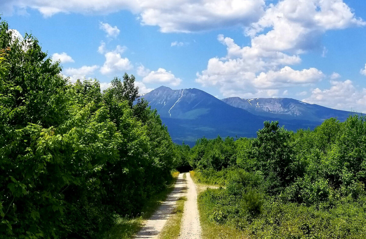
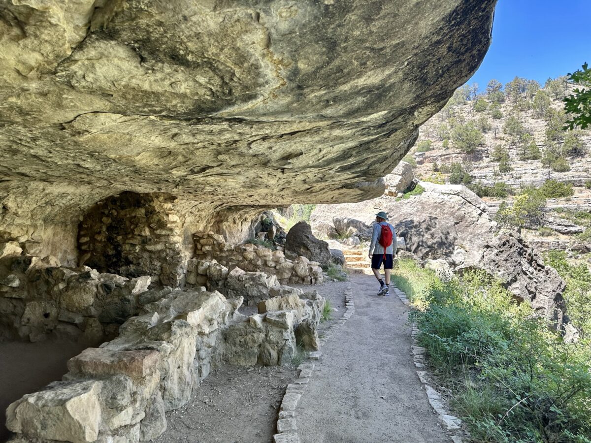
Conservation groups are rising to defend Baaj Nwaavjo I’tah Kukveni, also known as Ancestral Footprints of the Grand Canyon National Monument, from Arizona lawsuits. For almost a year, controversy has followed this 900,000-acre site adjacent to Grand Canyon National Park.

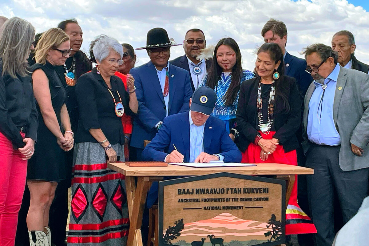
The national monument has great cultural significance to several Native American tribes. It also holds water critical for the Havasupai Tribe and resident wildlife such as bald eagles, mule deer, and chisel-toothed kangaroo rats. Last August, President Biden recognized the site’s importance by designating Baaj Nwaavjo I’tah Kukveni – Ancestral Footprints of the Grand Canyon a national monument.

As a White House fact sheet explains, “Baaj nwaavjo (BAAHJ – NUH-WAAHV-JOH) means ‘where Indigenous peoples roam’ in the Havasupai language, and i’tah kukveni (EE-TAH – KOOK-VENNY) means ‘our ancestral footprints’ in the Hopi language. The name reflects the significance of the Grand Canyon area, not just to one, but to many Tribal Nations.”

Aerial view overlooking the canyons of Baaj Nwaavjo I'tah Kukveni Ancestral Footprints of the Grand Canyon National Monument in Arizona.
U.S. Department of the Interior photo, via Earthjustice

Controversy arose from the Arizona legislature’s opposition to another national monument. In February, the legislature and others filed lawsuits to overturn the monument designation. They targeted the Antiquities Act, which allows presidents to establish national monuments at their sole discretion. Since President Theodore Roosevelt signed the Antiquities Act in 1906, 16 presidents have used it more than 150 times to establish new national monuments or to expand existing ones. The act has often proved unpopular with businesses looking to extract resources from these lands. A similar fight is ongoing in Utah over Bears Ears and Grand Staircase-Escalante National Monuments.

President Biden addressing a crowd at Baaj Nwaavjo I'tah Kukveni Ancestral Footprints of the Grand Canyon National Monument in Arizona.
U.S. Department of the Interior photo, via Earthjustice

In the case of Baaj Nwaavjo I’tah Kukveni, ranchers and uranium miners feel threatened. “Biden’s maneuver is incredibly disingenuous, as it has nothing to do with protecting actual artifacts,” Arizona Senate President Warren Petersen said in a statement in February. “Instead, it aims to halt all mining, ranching, and other local uses of federal lands that are critical to our energy independence from adversary foreign nations, our food supply and the strength of our economy.”

Two wooden posts in the dirt of a desert and scrub landscape in Arizona's Baaj Nwaavjo I’tah Kukveni – Ancestral Footprints of the Grand Canyon National Monument.
U.S. Department of the Interior photo, via Earthjustice

Conservation groups, who this week filed a motion to intervene in defense of Biden and the monument, tell a different story. “The critical significance of this lawfully designated monument to the well-being and long-term resilience of Tribal communities, Grand Canyon’s waters and wildlife, the Colorado River, our Grand Canyon state, the nation, and the world cannot be overstated,” Kelly Burke, executive director for Wild Arizona, said in a statement. “Apparently all this is lost on the Arizona legislature’s leadership, and is why we are committed to stand with Tribal nations in defense of this treasured living landscape against such self-serving attacks.”

Experience backcountry adventure within Maine’s Katahdin Woods

Immerse yourself in nature.

In 2016, Maine’s Katahdin Woods and Waters National Monument officially became part of the National Park Service. The region’s 87,000 acres of forests, rivers, and more beckon backcountry explorers for a visit. Give into your curiosity, and discover what this destination has in store.

If you’ve ever wanted to challenge yourself on a survivalist camping trip, this might just be the place to do it. As you journey into the Maine wilderness, expect to lose service and encounter few amenities. Guests are warned to bring plenty of fuel, food, and water. In exchange for giving up the comforts of modern life, visitors can enjoy outdoor adventures and natural wonders they’ll never forget. Start planning your visit with this list of the seven best things to do and see at Katahdin Woods and Waters National Monument.

Examine fossils at Mammoth National Monument in Waco, Texas

Take a look into the past.

In 1978, two men searching for arrowheads near the Bosque River in Waco, Texas, made the discovery of a lifetime. That discovery was the femur bone of a Columbian mammoth. Staff from the nearby Strecker Museum rushed to begin excavating the site. From then until 1990, the team worked to uncover the fossils of 16 Columbian mammoths. But that wasn’t where their exploration stopped. In another seven years, the crew found the remains of a camel, alligator, saber-tooth cat, and other animals.

Today, Mammoth National Monument marks the spot where these discoveries took place. Plan your visit to the area with this photo guide full of helpful information.

8 Bandelier National Monument photos that will inspire you to visit

Hike to waterfalls, pueblos, and more.

Where can you find caves, pueblos, and waterfalls in one place? At New Mexico’s one and only Bandelier National Monument, visitors can discover all of these sights and more. It’s a site full of natural wonders and history stretching back more than 10,000 years.

Located in Los Alamos, New Mexico, this fascinating region officially became a national monument in 1916. Long before that, the Ancestral Pueblo people built settlements throughout the area. Today, Bandelier National Monument invites visitors to explore remnants of these ancient villages. Discover intriguing landmarks like Tyuonyi Pueblo, or climb up the ladders to Alcove House. Learn more about these spots and the region’s top trails in this photo guide to Bandelier National Monument.

Glimpse into the lives of Pueblo people at Wupatki National Monument

Peer into Pueblo history.

On a hot, windy day, we wandered down a short trail to Wukoki Pueblo. It’s one of several pueblo sites you can visit within Wupatki National Monument. We were only an hour from Flagstaff, Arizona, but the old dwelling felt remote. 

Two park volunteers told us about the Hopi people who once lived here. “How would you like to stand in a 900-year-old tower?” one asked. We crouched down through tiny doorways — me looking carefully for rattlesnakes — then stood up at the base of a three-story tower, marveling at the people who had built this old structure out of red stones.

A red stone pueblo.
Photo by Teresa Bergen

Wupatki occupies 56 dry square miles of land on the southwestern Colorado Plateau. It’s connected with Sunset Crater Volcano by a 35-mile loop road, and a single entrance fee gets you into both parks.

Communities occupied the pueblos from about the 1100s. They developed ways to live despite climate extremes and scarce water. Their homes range from one-story, single-family dwellings to complicated high-rises reminiscent of condos. They were built with sandstone slabs, basalt chunks, and limestone blocks set with mortar. Amazingly, the homes are still somewhat intact 700 years after the residents left.

Wupatki Pueblo, a red stone structure in the desert.
Wupatki Pueblo. / Photo by Teresa Bergen

The people lived on a diet of corn, squash, beans, grains, seeds, and fresh meat from hunting. Plants served medicinal, nutritional, and practical purposes. People used rabbitbrush to treat headaches and for green and yellow dyes. Hopis added saltbush wood ash to cornmeal when making bread. This provides niacin, which helps prevent protein deficiency in people who depend heavily on corn. You’ve got to wonder how people figured that one out.

Wupatki became a national monument in 1924, thanks to President Calvin Coolidge. Archeologists still debate many Wupatki topics, including their trading patterns. There’s evidence of interaction with other early people. Homes were built in an Anasazi way but included Sinagua-style textiles, pottery, and tools. A large ball court has intrigued archeologists since the 1930s. What sort of game was played here? And did the game come from the Aztecs or Mayans, who had similar ball courts

Red stone structures in a desert.
The mysterious ball court at Wupatki Pueblo. / Photo by Teresa Bergen

Visitors can explore several different pueblo sites. The Citadel and Nalakihu pueblos are next to the main road. Getting to Wukoki Pueblo requires driving a 2.5-mile spur road. It’s a half-mile trail hike to Lomaki Pueblo. All sites, except Lomaki and Box Canyon Pueblo Trails, are at least partially wheelchair-accessible.

Come prepared. There are no gas stations, restaurants, or overnight accommodations inside the monument. Fill up your water bottles ahead of time. Bonito Campground near Sunset Crater is open from late spring through early fall. It has running water and restrooms but no showers.

Explore curious cliff dwellings at Walnut Canyon National Monument

Tour the canyon and caves.

A visit to Walnut Canyon National Monument lets you imagine yourself 700 years back in time when earlier people lived in cliff dwellings with incredible views. Check out the forested canyon, the cacti, and the blue sky. You might just fantasize about living here yourself.

Limestone caves.
Cliff dwellings at Walnut Creek National Monument. / Photo by Teresa Bergen

The monument is 10 miles southeast of Flagstaff, Arizona. Archeologists refer to the 12th- and 13th-century inhabitants as Sinagua cave dwellers. But don’t mistake these folks for cavemen. People lived in a complicated and cooperative society in the canyon. 

Their dwellings were very clever. They used what nature provided — back walls, floors, and leak-proof ceilings — in the rock alcoves. Then, they built thick side walls out of limestone blocks and mud, providing insulation and retaining heat in winter. They probably decorated their living spaces with rugs and hung animal skins over the small door openings facing the canyon.

A scrub-lined canyon.
Early cliff dwellers had sensational canyon views. / Photo by Teresa Bergen

Archeologists think the larger rooms were living spaces, and the smaller rooms stored water, food, and tools. They might have kept a 100-day water supply in large pottery vessels. Archeologists have recovered sandalsknives, and tools for making arrow shafts and pottery.

Walnut Creek created the surrounding 400-foot canyon. The cliff dwellings are naturally carved from Kaibab limestone. Early people added a hole to let smoke escape from their heating fires.

A hole in a cave wall.
Smoke escaped through a hole high up in the cliff dwelling. / Photo by Teresa Bergen

On a recent visit, the site felt very peaceful and quiet (despite quite a few visitors). There was little sound except the wind and an occasional passing bird. The one-mile Island Trail — paved, with stairs and handrails — descends 185 feet into the canyon. At almost 7,000 feet in elevation, it can be a little strenuous on the way back up, especially if you’re a sea-level dweller. Hike slowly, and be sure to carry some water with you. The trail is too steep for wheelchair users, and pets aren’t allowed.

A blue sky above a scrub-lined canyon. A small building sits at the top of the canyon.
The visitor center on top is built to blend in. / Photo by Teresa Bergen

Alternatively, you could take it easy and stay on the Rim Trail above, from which you can look down into Walnut Canyon. At the top, the monument has a nice interpretive center with a good selection of Arizona books.

Feel the power of a volcanic eruption at Sunset Crater National Monument

Visit Arizona’s Sunset Crater Volcano.

More than a thousand years ago, around 1085 CE, a volcano in what is now Arizona had a massive eruption. The ground tore open, and lava shot 850 feet into the sky. At Sunset Crater Volcano National Monument, you can still see the greatly altered landscape and different types of lava left over from the eruption.

A bush of small white flowers in front of a volcanic hill dotted with trees.
Photo by Teresa Bergen

Sunset Crater has the type of lava fields you’d expect to see in Hawai’i. The ancient Arizona eruption covered almost 900 square miles with ash and lava. Experts estimate that the ash cloud was five miles tall and could have been seen from Durango, Colorado, and Las Vegas, Nevada.

Now a national monument, Sunset Crater is about a 30-minute drive north of Flagstaff, Arizona. The volcano is one of approximately 600 cinder cones that make up the San Francisco Volcanic Field. The region’s history of intense volcanism dates back about 3 million years.

A hiker on a dirt trail surrounded by trees and scrub.
Photo by Teresa Bergen

Sunset Crater gets its name from the colorfully rimmed cinder cone. Explorer John Wesley Powell, who explored the area in 1885, wrote, “The contrast in the colors is so great that on viewing the mountain from a distance the red cinders seem to be on fire.” 

Local names given to the crater by Indigenous people also commemorate color and volcanic power. The Hopi call it Palatsmo (Red Hill), the Dilzhe’e Apache say Ha Gudni Káá (Where It Burned), and the Diné dub it Dził Bilátah Łitsoí (Yellow-Tipped Mountain).

A rocky landscape overlooking a mountain ridge.
Check out lava formations on one of the monument’s short trails. / Photo by Teresa Bergen

The monument’s longer trails are currently closed due to fire damage. But three short trails remain open. The Lava Flow Trail, a one-mile loop, is wheelchair-accessible and an easy stroll. Pets are allowed on the trail’s paved portion. The Bonito Vista Trail, also wheelchair-accessible, is a tiny .3-mile trail that lets you explore a field of cinders. For a close-up look at jagged lava, hike the .25-mile A’a Trail. There’s also a visitor center and plenty of interpretive signage to help you learn about volcanic history. Or you can just enjoy the colors of the cinder cone and local plant life.

Trees and scrub in a rocky landscape.
Bright flowering cacti dot the monument. / Photo by Teresa Bergen

Sunset Crater’s trails remain open at night to allow for stargazing. The monument is also an International Dark Sky Park. Rangers offer sky-viewing programs at certain times of year. Visitors can observe meteor showers, learn about constellations, and look through telescopes. The monument’s otherworldly landscape is reminiscent of the moon. In fact, NASA astronauts have trained at Sunset Crater. They practiced collecting rock samples, mapping terrain, and setting up scientific instruments on the monument’s moon-like landscape.

What you need to know before visiting Vermilion Cliffs National Monument

Say hello to The Wave.

Don’t let people trick you into thinking deserts and canyons are boring. In Arizona, these rocky landscapes are home to some of the most fascinating geological formations on Earth. No, we’re not talking about the Grand Canyon. Instead, we’re traveling a little further north to the remote wonderland of Vermilion Cliffs National Monument.

If you’re seeking sandstone canyons and colorful rock formations, this dreamy region is the place to go. Adventurers who explore Vermilion Cliffs National Monument will find 294,000 acres of unbelievably gorgeous wilderness. Landmarks like The Wave (aka Coyote Buttes North) decorate the world in bright swirls of color, while spots like White Pocket treat visitors to shocks of white rock.

Want to plan a trip to this incredible destination? Resources from Recreation.gov and BLM can help coordinate the technical side of your travels. For details on all the fun sightseeing opportunities, check out the gallery of tips and Vermilion Cliffs National Monument photos below.

Uncover new landscapes at Craters of the Moon National Monument & Preserve

Hike through unique habitats.

National parks get a lot of love on Outdoors Wire. These destinations aren’t the only National Park Service (NPS) sites that deserve a visit, though. Some areas, like Craters of the Moon National Monument & Preserve, even have landscapes that rival those found in national parks.

Historic lava flows formed Idaho’s Craters of the Moon National Monument & Preserve. Described by the NPS as “weird and scenic,” the area is full of martian-esque features. Adventurers will find craters, of course, but they’ll also discover wildflowers blooming out of ancient black lava. Even night owls can enjoy the region for its clear, starry skies. Explore these sights and more in the gallery below.