Brian Kelly on potential impact of tropical storm on Alabama game

It’s still too early to know the exact impacts Rafael will have on Louisiana, but Brian Kelly said LSU is monitoring the situation.

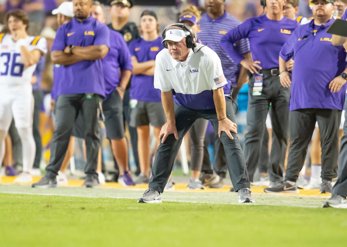
LSU football head coach [autotag]Brian Kelly[/autotag] met with the media on Monday. Usually, the conversation remains focused on the game at hand, but with a tropical storm in the Gulf, Kelly took a moment to address it.

“The one thing I didn’t have to think about, I thought, was another storm coming,” Kelly said.

“As we get closer to game time, probably (Tuesday), we’ll have to look a little bit closer at the weather situation. It’s definitely on the list now,” Kelly said.

The storm, named Rafael, would reach the United States this weekend.

In a social media post, meteorologist James Spann wrote “It is still too early to know what, if any, impact there will be on the Alabama/LSU game in Baton Rouge Saturday night. For now, we’re just forecasting a chance of showers. That could change in the coming days.”

Right now, The Weather Channel forecast for Baton Rouge on Saturday night states “overcast with rain showers at times. Low 67F. Winds light and variable. Chance of rain 40%.”

If that holds, I’d expect LSU and Alabama to play without issue. Rafael is expected to reach hurricane status over the Gulf of Mexico, but weaken as it approaches the U.S. coast.
Saints preparing for possible impacts of Tropical Storm Francine

The New Orleans Saints are preparing for impacts of Tropical Storm Francine. Dennis Allen says his team does this ‘better than anyone in the National Football League’

We’ve approached the peak of hurricane season along the Gulf Coast, and the New Orleans Saints are monitoring the progress of Tropical Storm Francine as it makes its way north through the Gulf of Mexica. Francine is projected to be upgraded to hurricane status soon, though it’s too early to say just how strong its sustained wins and damaging impacts may be before it reaches  Louisiana.

Saints head coach Dennis Allen said on WWL Radio Monday evening that he’ll hold a Zoom meeting with players on Tuesday, their normally-scheduled day off, to go over changes to the practice schedule for the rest of the week. Francine is expected to intensify into a hurricane before making landfall along the Southern Louisiana coast on Wednesday.

And as he noted earlier in the day when speaking with local media, “We do this better than anyone in the National Football League.” The Saints have had to work around dangerous storms in recent years like Hurricane Ida in 2021 and Hurricane Zeta in 2020, so they know the drill. They don’t have plans to evacuate from New Orleans at this time.

If you’re in the area, be safe. Finish your hurricane preparations soon and follow advisements from local authorities. Anyone who has ridden out a strong storm like this before can attest to how dangerous they can be, and if  you’re in Tropical Storm Francine’s path, you shouldn’t take it lightly.

[lawrence-auto-related count=5]

Rare West Coast hurricane forecast to strike Los Angeles after Saints preseason game

A rare West Coast hurricane has been forecast to strike Los Angeles after Sunday’s Saints preseason game. Hurricane Hilary is a Category 1 right now, but it’s rapidly strengthening:

Don’t take this lightly. The National Hurricane Center announced Thursday morning that a tropical system off the coast of Mexico is now a Category 1 hurricane, named Hurricane Hilary, with measured sustained winds at 75 miles per hour.

We’re approaching the peak of hurricane season, and many New Orleans Saints fans in Louisiana and across the Gulf South are well-attuned to this dangerous weather threat. Just two years ago the region was struck hard by Hurricane Ida, prompting the Saints to move their entire organization to Dallas so they could finish training camp, kicking off their Week 1 “home” opener at the Jacksonville Jaguars’ stadium instead.

But what’s unusual is that Hurricane Hilary is approaching the West Coast. The NHC forecasts the storm to run up the Baja California peninsula before making landfall in Southern California overnight Monday. Excessive rainfall and potential flooding is predicted for major metro areas in Los Angeles and San Diego, potentially reaching as far inland as Reno, Nev. by Tuesday.

And the Saints are currently in Los Angeles for their preseason game with the Chargers on Sunday at SoFi Stadium. Kickoff is scheduled for 6:05 p.m. CT/4:05 p.m. PT, so the team will have plenty of time to finish their exhibition game and fly back to New Orleans. It could be dicey for fans and media traveling to Los Angeles who aren’t able to immediately leave Sunday evening, though.

The NHC advises that Hurricane Hilary is strengthening rapidly and that it could be upgraded to a major hurricane later Thursday. The storm will weaken after making landfall in Baja California, but to what degree is unclear. If you’re in the area make preparations now and stay tuned for updates from the NHC, local authorities, and emergency services.

West Coast hurricanes are rare. A number of geographic and atmospheric conditions make it difficult for tropical storms to form and sustain themselves, including the powerful cold-water California Current running down from the North Pacific. But they’ve happened before. Los Angeles’ 24-hour rainfall record was set back in Sept. 1939 when a tropical storm dropped more than 5 inches of rain on the area. Last year, Hurricane Kay peaked as a Category 2 before deteriorating after landfall in Baja California, ultimately just grazing the Southern California coast. Hopefully Hurricane Hilary takes a similar track.

[lawrence-auto-related count=3]

Typhoon expected to hit near Tokyo on Tuesday, could make for a soggy start to Olympic men’s golf competition

Several inches of rain could fall in Tokyo during the tropical storm, leaving soggy conditions in its wake at Kasumigaseki Country Club.

The Olympic golf competition may be in for a soggy start, as the men are scheduled to begin play Thursday just days after a weak typhoon is predicted to make landfall Tuesday north of Tokyo.

Tropical Storm Nepartak is a mid-grade tropical storm by U.S. categorizations, the Associated Press reported. It could dump several inches of rain on Kasumigaseki Country Club northwest of Tokyo, which is on the eastern, Pacific Ocean-facing side of Japan. Maximum gusts have approached 70 mph, the Japan Meteorological Agency reported, with sustained winds of about 45 mph.

“It is a tropical storm of three grade out of five, so you shouldn’t be too much worried about that, but it is a typhoon in Japan interpretation,” Tokyo Games spokesman Masa Takaya said. “This is the weakest category, but this is still a typhoon so we should not be too optimistic about the impact of the course (of the storm).”

The storm, which is approaching the island nation from the east, is predicted to be gone from the area before the men tee off Thursday morning. But the golf course’s drainage could be tested, and there is a high probability of more rain throughout the next two weeks. The men play July 29-August 1, and the women play August 4-7.

[listicle id=778113059]

[listicle id=778112022]