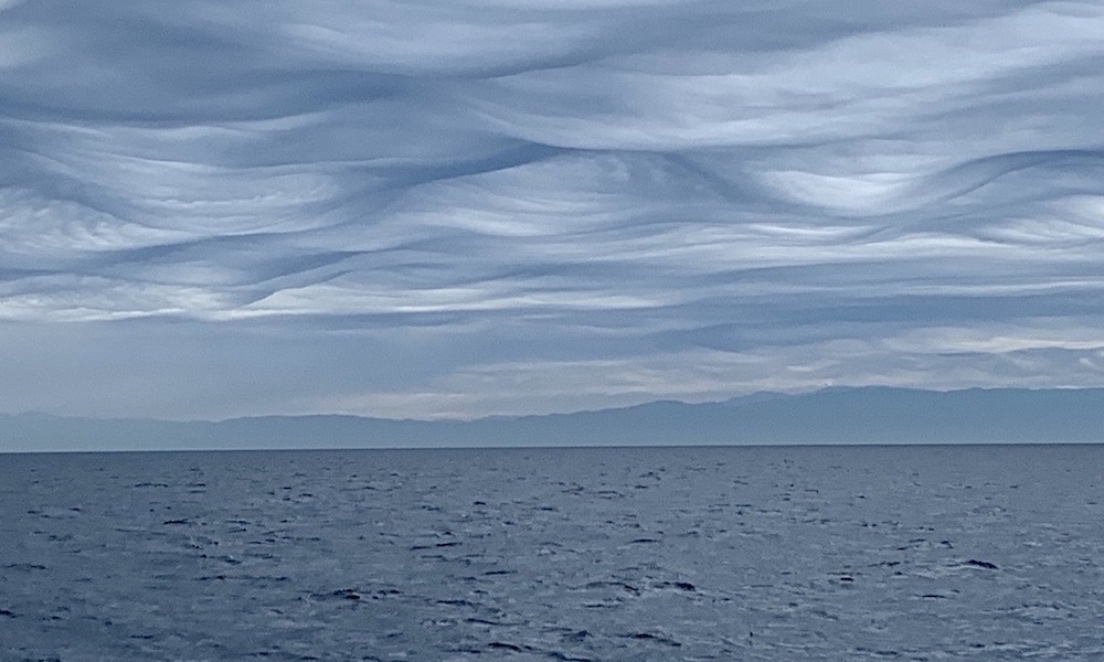
A Channel Islands National Park ranger on Wednesday boated across the channel beneath a sky that appeared wavier than the ocean.
The agency featured two images of the surreal-looking cloud formations beyond the Oxnard-Ventura area, explaining to followers via X:
“Check out these rare cloud formations today in the Santa Barbara Channel. A ranger captured this while returning to the mainland. These are asperitas clouds, known for their dramatic wave-like appearance on the underside of the cloud. Asperitas translates to ‘roughness’ in Latin.”

The International Cloud Atlas states that aspertitas “is characterized by localized waves in the cloud base, either smooth or dappled with smaller features, sometimes descending into sharp points, as if viewing a roughened sea surface from below.
“Varying levels of illumination and thickness of the cloud can lead to dramatic visual effects.”
The clouds materialized during an atmospheric river event that delivered heavy rainfall to Southern California. A second wave is expected to arrive beginning late Friday.


